 vesseltracker.com
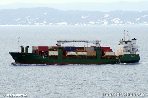
Vessel ISLA TAUTIL IMO: 9006227, MMSI: 725003474 General Cargo Ship
UTC, -51.93219, -72.90811, course: 320, speed: 0.1
UTC, -51.93186, -72.90772, course: 285, speed: 0
2026-01-29 04:14:51 UTC, -51.93134, -72.90763, course: 251, speed: 0
Live AIS position:
UTC. 19 nm SW of PUERTO NATALES),
updated 2026-01-29 04:14:51 UTC.
Find the position of the vessel ISLA TAUTIL on the map. The latter are known coordinates and path.
marine traffic ship tracker show on live map
The current position of vessel ISLA TAUTIL is -51.93134 lat / -72.90763 lng. Updated: 2026-01-29 04:14:51 UTCCurrently sailing under the flag of Chile
ISLA TAUTIL built in 1991 year
Deadweight:
2750 tDetails:
Last coordinates of the vessel:
UTC, -51.93201, -72.90780, course: 295, speed: 0UTC, -51.93219, -72.90811, course: 320, speed: 0.1
UTC, -51.93186, -72.90772, course: 285, speed: 0
2026-01-29 04:14:51 UTC, -51.93134, -72.90763, course: 251, speed: 0